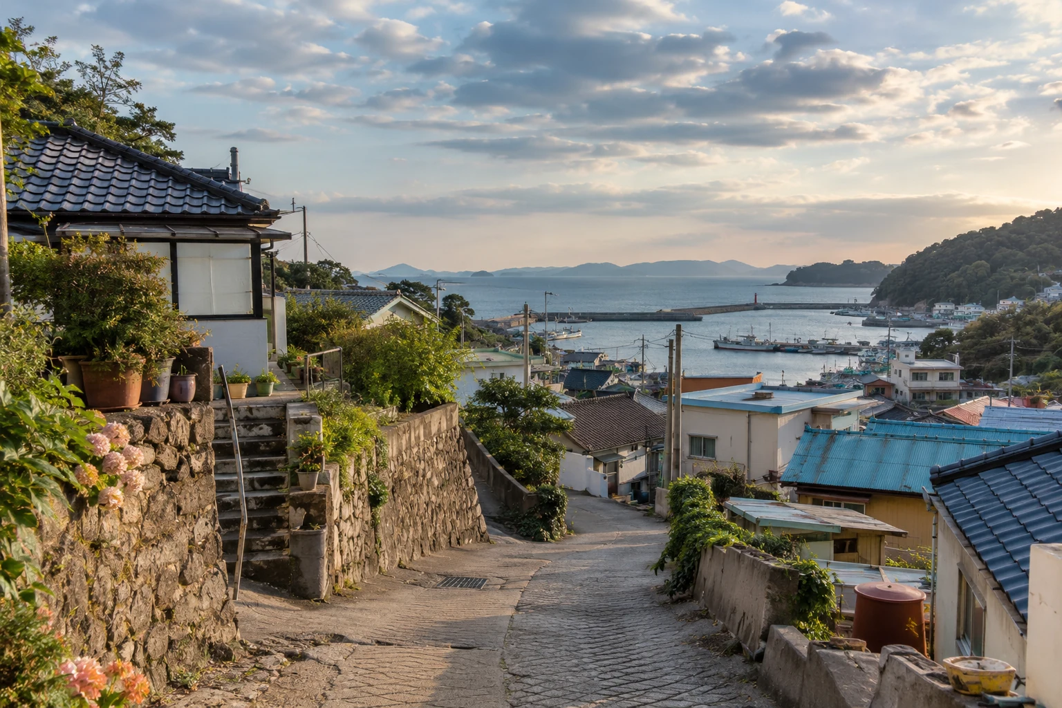
Where does a trip called Seoul actually take place?
Imagine arriving at Incheon Airport, sleeping in Gyeonggi Province and attending a concert in Seoul. This is an illustrative journey, rather than a reported traveller’s experience. On returning home, someone might simply say they went to Seoul. That works in conversation. To explain the transport they used, the home they slept in and the venue they visited, however, we need three distinct places. Seoul, Incheon and Gyeonggi are separate metropolitan administrative jurisdictions. Together they form the capital region; Seoul is one part of it.
A place’s name and the space that keeps it running can differ because daily life crosses boundaries. An office worker photographed on a Seoul street might live there, or might have travelled from Incheon or Gyeonggi. In the evening that person can return to a grocery shop and home elsewhere. The photograph shows a workplace district, but it does not establish everyone’s residence. Housing, employment and the journeys between them all belong in the picture. The National Atlas’s account of the capital region groups Seoul, Incheon and Gyeonggi together.
Seoul is an understandable entrance to Korea. Yet when its familiar streets become a shorthand for everyone’s life, other centres disappear. Some cities send people toward car factories and shipyards rather than clusters of offices. On an island, roads between mountains and the coast connect schools, markets and healthcare. Instead of extending a list of attractions, this article follows Ulsan’s industrial spaces and Jeju’s transport routes to see how different places hold an ordinary day together.
What the capital region’s 50.9% tells us
The official summary of the population and housing census, with a reference date of 1 November 2025, puts the capital region’s population share at 50.9%. That is not Seoul city’s share. It combines Seoul, Incheon and Gyeonggi and compares their population with the national population of the Republic of Korea, rather than the entire Korean peninsula. The date and geographical denominator are part of the fact, as the official results republished by KDI make clear.
A little over half the population in one region represents substantial concentration. It also means that nearly half live outside it. Their homes, workplaces, school journeys and shopping are not an appendix to Korean life. A capital-region population share cannot by itself explain transport or housing elsewhere. It tells us where people are concentrated, but not what they make, which routes they use or how a working day unfolds.
Even the capital region is not a single landscape. Established urban centres, new towns, farmland and coastal areas can belong to it. Beyond it are large cities, industrial centres, university districts, farming and fishing communities and islands. A capital-region-versus-everywhere-else division is a starting point. Understanding a particular city means looking again at where its workplaces and homes lie and how transport links them. A national proportion and a neighbourhood experience operate at different scales.
Ulsan’s production does not stop at the factory gate
The National Atlas describes the growth of southeastern coastal cities, including Busan, Ulsan and Changwon, alongside the growth of the Seoul region. Korea’s urbanisation cannot be explained solely through migration toward the capital. Coastal industrial cities developed around ports that received materials and dispatched products, production facilities and the housing of people who worked there. Reading the two axes of urban growth together shows that cities did not all expand for the same reasons.
Put the automotive, shipbuilding and petrochemical industries identified by Ulsan on a map. The Ulsan–Mipo national industrial complex extends across areas of Nam-gu, Dong-gu and Buk-gu. Onsan’s national industrial complex lies in Onsan-eup, Ulju-gun. All employment is not collected beside one central shopping district. The designation of Ulsan’s special industrial district dates to 27 January 1962, followed by the industrial centre’s groundbreaking on 3 February. Onsan was designated an industrial-base development area on 1 April 1974. Subsequent plans, designations and construction shaped these industrial spaces. Ulsan’s Mipo project information and industrial-complex history identify their locations and beginnings.
Factory buildings alone cannot sustain production. Materials need a port through which to arrive, and products need routes out. Roads and railways move freight between those gateways and production sites. Industrial water and electricity support operations; wastewater needs treatment. This is why Mipo’s official information discusses supporting infrastructure separately. Ships and storage facilities in a harbour photograph are also links between stages of production. Following those links reveals a city’s scale through movements of materials and products, rather than building height alone.
These routes meet people’s journeys to work. An office district and a large industrial complex offer different destinations, and the connection from housing to each needs its own examination. The names of industries do not establish every worker’s hours or choice of transport. Calling Ulsan an industrial city gives us questions to investigate, rather than a substitute for its residents’ varied lives.
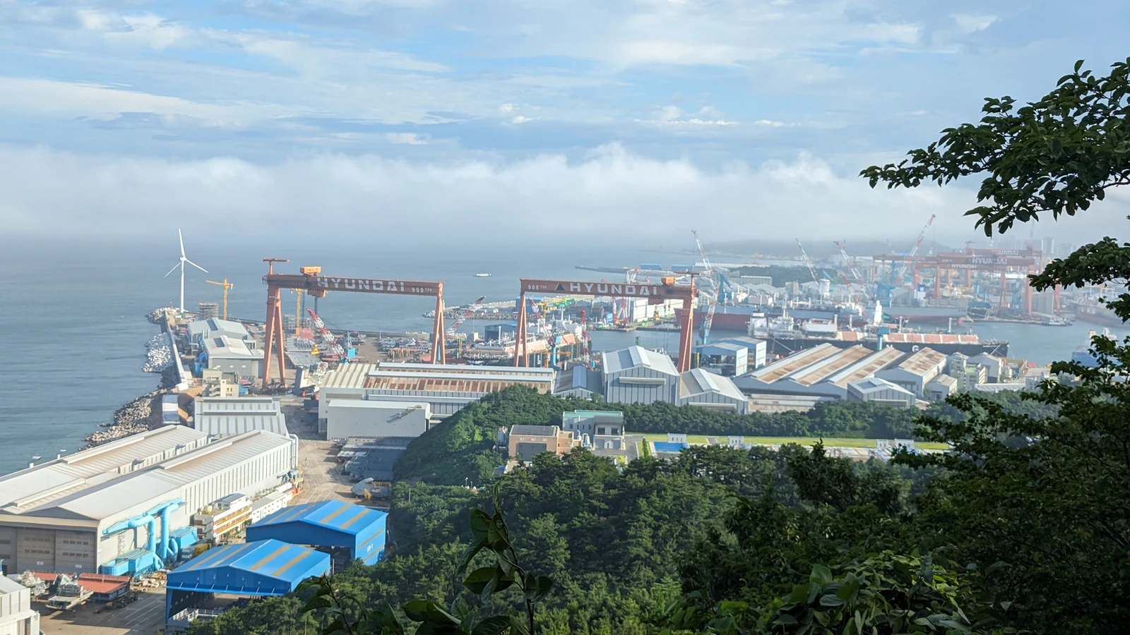
Jobs come with homes and responsibilities for safety
Accounts of industrial cities often finish with production totals and export products. Beyond factory gates are homes to which people return after work. Ulsan’s official safety information describes industrial and residential areas moving closer as the city and its complexes expanded. It also discusses how accidents in areas with concentrated hazardous-material facilities can affect neighbouring businesses and residents. Industrial growth connects to environmental and safety management as well as employment.
Two different claims must remain distinct. The spatial proximity of industry and housing can be documented. It does not establish that every home in Ulsan is dangerous. Applying one risk level to an entire city without examining facilities, incidents and responses would erase differences again. Conversely, describing only employment while leaving out neighbouring homes and environmental conditions is also incomplete. A factory is a working space, and its surroundings include places where people raise children, eat and sleep.
A map that explains Ulsan therefore needs workplaces, ports and freight routes alongside housing and everyday facilities. Infrastructure supporting production and facilities supporting residents belong in the same account. This article does not turn company counts or facility capacities from older industrial information into present-day figures. Historical beginnings and the roles of infrastructure can be explained; current scale requires a separate, up-to-date measurement.
Two roads between Jeju’s north and south
Draw a straight line from Jeju City to Seogwipo and the island’s movement appears simple. Hallasan and volcanic terrain lie between them, while actual journeys follow roads and stops. Mountains and coast create striking scenery and also affect the directions in which people travel. Photographs presenting Jeju solely as a nature destination cannot explain its residents’ school journeys, healthcare visits or shopping.
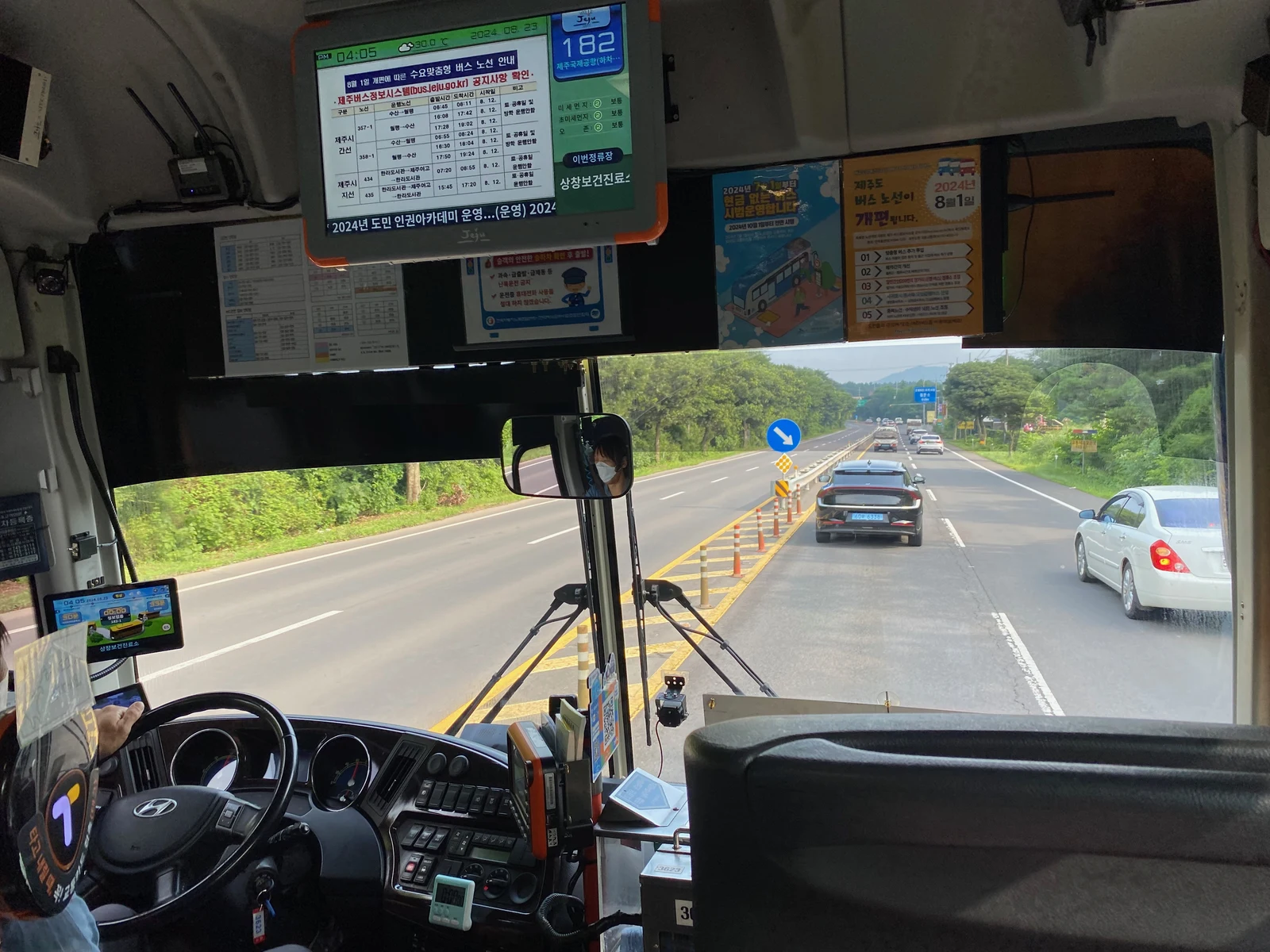
Compare routes 181 and 182 in the official Jeju Bus Information System. Route 181 travels via Road 516 to Seogwipo and returns in the direction of Pyeonghwa-ro. Route 182 travels via Pyeonghwa-ro to Seogwipo and continues back via Road 516. Both link the northern and southern cities, but they encounter roads and stops in a different sequence. Direction and the places reached along the way matter even when the two city names are the same.
There is more than one coastal route, too. Route 201 follows the eastern coastal road through Jeju Bus Terminal, Seongsan Ilchulbong and Seogwipo Bus Terminal. Route 202 follows the western coastal road via Gosan 1-ri toward Seogwipo Registry Office. Its endpoint should not be casually replaced with the terminal named on route 201. East and west, coast and inland slopes introduce several different paths into the loose description of travelling around the island. These comparisons explain geographical routes; they are not a timetable or a claim that one bus is always fastest.
Stop names reveal everyday destinations
A visitor’s prominent landmarks might be a beach, lookout or museum. A resident’s important places also include a school used repeatedly, a market and a public health centre. Jeju’s route lists put both kinds of destination on the same island. Route 621 includes Harye-ri Entrance, Sinrye Elementary School and Seogwipo’s traditional five-day market. Route 635 includes that market, Seogwipo Public Health Centre and Namju Middle and High Schools. Following the names reveals routes for education, buying ingredients and using health services.
People sharing a road can attach importance to different moments. A temporary visitor might plan the order in which to see scenery. Someone returning to a school or clinic needs a connection between departure point and destination. This is an interpretation of the facilities listed on routes, rather than a survey claiming to know how frequently particular residents use them. A route’s existence also does not prove that everyone has adequate transport. Actual accessibility requires service times, transfers and the distance from a home to a stop.
The point is not to look less closely at Jeju’s landscape. It is to retain the schools, markets and homes between the mountain and the coast. Travel organised around a view meets travel organised around an ordinary day on the same roads. Once that overlap is visible, the island becomes a region of continuing, varied lives as well as a setting for a holiday.
Names can remain while administrative areas change
Using a place name correctly involves more than spelling it. A name does not always describe the same territory at different dates. Jeju Special Self-Governing Province’s establishment in 2006 and Sejong Special Self-Governing City’s in 2012 changed the administrative map. Historical accounts in the National Atlas explain those changes, but their lists cannot simply be passed off as current. An early-2026 document listing 17 metropolitan jurisdictions, with Gwangju and Jeonnam separately, needs its original reference date.
On 1 July 2026, the integrated Jeonnam–Gwangju special city was established. Article 7 of the current special act abolishes the former Jeollanam-do and Gwangju Metropolitan City and establishes the integrated special city directly under the national government. The territory meant by an older description of Gwangju therefore needs to be distinguished from the integrated jurisdiction. The larger administrative unit containing a home can change without its residents moving.
Statistical tables also respond. Official post-integration statistical notes explain the use of the integrated territory for comparisons with earlier periods and the separate presentation of former areas. An old name surviving in a table does not mean integration did not happen. A new name beside a number does not establish that all older numbers covered the same territory. Name, actual coverage and reference date must be read together to explain changes affecting even those who have stayed in the same home.
Reading a life that continues beyond a boundary
Administrative boundaries assign responsibility and organise statistics. They do not contain every part of a day. A person can work in a different city from the one in which they live; their school or market may lie in another direction from their jurisdiction’s centre. Imagine someone living between two cities, travelling east for work and west to shop. Their address cannot tell us the full range of places keeping their day going.
Household comparisons require similar care. A high proportion of one-person households and a large number of them are different claims. A lower proportion in a large city can represent more households than a higher proportion in a smaller area. An older population’s share can rise as the total population falls. A citywide average can hide differences between a new town and an established centre. When applying household changes or apartment statistics to a region, a national share should not become a description of one neighbourhood.
Reading Korea beyond Seoul can be more interesting than attaching provincial attractions to the end of a capital-city itinerary. In Ulsan, follow the connections between production, ports, infrastructure, workplaces and housing. In Jeju, follow roads around mountains and coasts to schools and markets. Describing each region only by its distance from Seoul hides the work it does. Begin with the definitions in Places of Korea: names and boundaries, then follow actual routes: the map gains several centres.
The Korea I find more compelling is not a search for smaller versions of the capital. It is a country where familiar activities—working, shopping, eating and sleeping—continue in different spaces. The differences are not confined to spectacular attractions. They are present in a port receiving materials, a bus stop naming a health centre and a journey home across a boundary. Looking closely at these ordinary connections brings a Korea that one city’s name cannot contain into view.
Read a region through the production, journeys and homes it connects, rather than only its distance from the capital.
Sources & scope
2025 population and housing census: official republication ↗2026-07-28Urban development and changing administrative areas ↗Internal migration in Korea ↗Growth of the capital region and southeastern coastal cities ↗2026 immigration policy implementation plan: early-year historical document ↗2026Ulsan’s investment environment ↗Hallasan National Park ↗Jeju’s ordinary bus routes ↗Ulsan-Mipo industrial infrastructure ↗Industrial development and residential proximity in Ulsan ↗Jeju bus routes and their destinations ↗Establishment of the integrated Jeonnam-Gwangju city ↗Statistical coverage following the July 2026 merger ↗Modules independently explains the verified sources. The lead image is AI-generated for illustration; it is not a documentary photograph of an actual place, event or product.
Updates & corrections
Dates record changes to this document, separately from the reference dates of its sources.
- Content update
Rewrote the article with fuller production, history, examples and source explanations.
- Document connections
Organised representative-document links, search descriptions, paragraph links and revision history. No factual correction.
- First published
Initial creation of the Korean and English document.